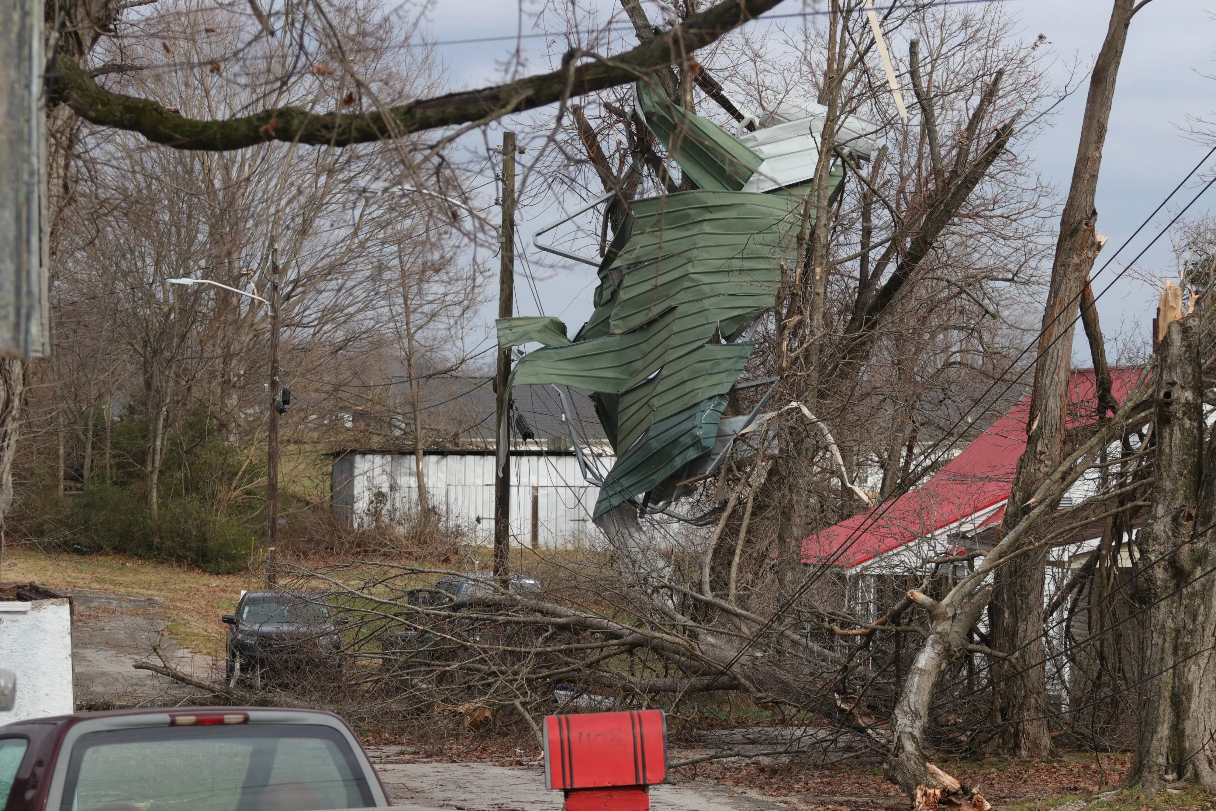
Debris from a home hangs in trees following a series of straight-line winds and tornadoes in Cave City between Friday, Dec. 10 and Saturday, Dec. 11, 2021.
(BRENNAN CRAIN/WCLU NEWS)
GLASGOW — The National Weather Service reported early Wednesday that Barren County is now in an “enhanced” category for severe weather potential.
The information was published in their daily severe weather outlook. Counties west of Barren County fall into the “enhanced” and “moderate” risk categories.
Multiple rounds of storms are possible Wednesday and through the evening into early Thursday. Weather officials estimate the severity of storms should reach their height between 6 p.m. and 11 p.m.
“Damaging winds and isolated tornadoes are the main threats, although larger hail and localized flash flooding are possible,” according to the weather outlook.
Barren County officials urged Tuesday that residents prepare for severe weather, especially this time of year when chances are more frequent.
The county’s “safe rooms” are open and in “active-ready” status. That means anyone in the county may enter one of those rooms in the event of severe weather.
Click here for a complete list of safe room locations in Barren County.
Localized flooding is a concern near the southern portion of the county, officials said.
“You have more of the hills in that area, which you’ll have the bulk of the low water fords,” said Judge Executive Micheal Hale. “And the majority of them set lower than the road itself.”
Because flash flooding is possible with the storms, it is necessary to prepare for commutes, Hale said. Barren County has about 40 fords, which are areas where water is shallow but has the potential to flood over the roadway.
“Folks that are traveling that way, they just need to be cautious,” said Judge Executive Micheal Hale.
On the other hand, the northern portions of Barren County are home to the ideal terrain for tornadoes. It is flat and has fewer hills, which allow touchdowns more often, Hale said.
A tornado damaged several properties in Cave City and Park City between Dec. 10 and 11, 2021, and Jan. 1. The December storms damaged several communities across western Kentucky, including Mayfield, Bowling Green and parts of Hart County.
The timing might shift, but the system is expected to pass from the area by early Thursday.
Stay tuned to WCLURadio.com and the WCLU Radio app for the latest and breaking news.