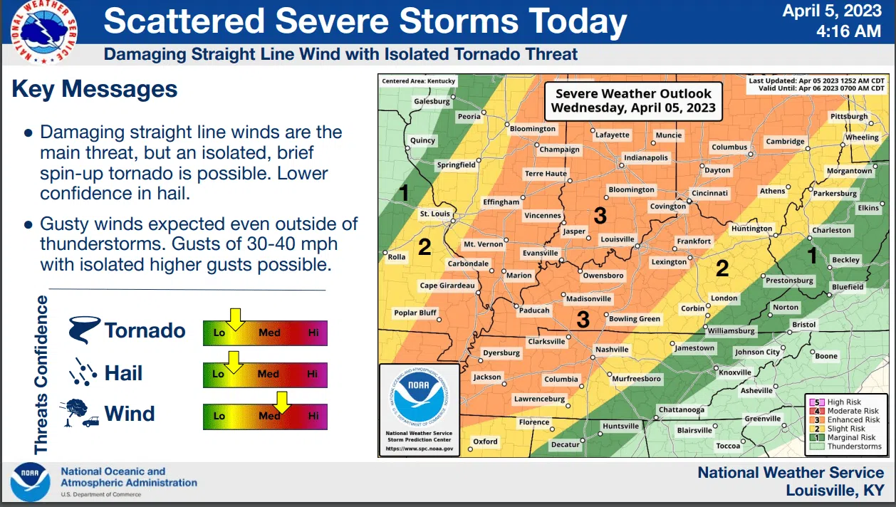
GLASGOW — More severe weather is on the way for much of Kentucky. Here’s what we know and how local emergency management officials are preparing.
Scattered severe storms are likely on Wednesday and into Thursday. Damaging straight line winds along with isolated tornadoes are possible, according to the latest briefing from the National Weather Service. There is not great confidence for hail.
Saferooms in Barren County were being placed in “open-ready status” on Wednesday morning, according to Glasgow/Barren County Emergency Management.
Gusty winds are also expected through Wednesday. Gusts could range from 30-40 mph at times. Isolated gusts at higher speeds are possible.
Counties in the central portion of Kentucky like Barren County are expected to see the most weather activity from 3 p.m. to 7 p.m. Counties to the west could see it as early as noon while those to the far-east are expected to see severe storms later into the evening and early morning hours on Thursday.
Widespread periods of heavy rainfall is expected across Kentucky. One to 2 inches could fall in some areas.
A wind advisory remains in effect through 7 p.m. CST.